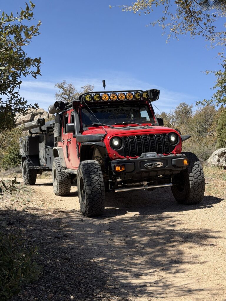
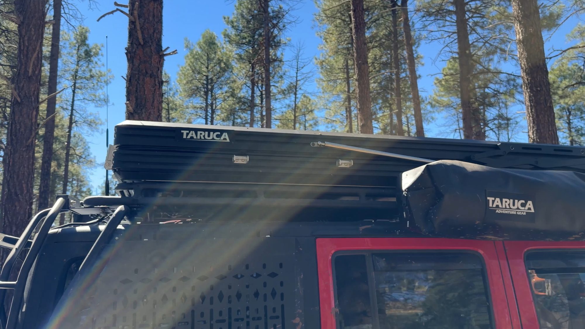
| Rig | Clifford (2015 JKU) · Turtleback stayed at camp · Taruca Dark Rogue 2.0 tent |
| Route | Flagstaff side → Casner Mountain Trail #8 → Sedona (89A) |
| Distance | Full route to 89A in Sedona: ≈43 mi from I-40 · ≈44 mi from I-17 · ≈39 mi from 89A north · 6.5 mi gate to gate |
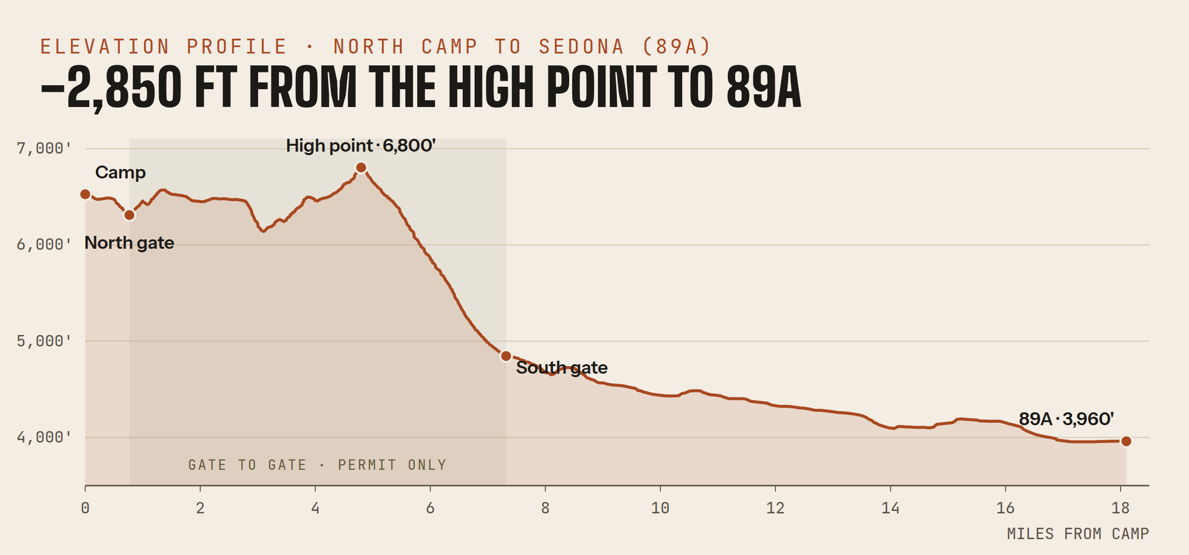
| Elevation | 6,800′ high point → 4,840′ at the south gate → 3,960′ at 89A |
| Duration | 3 days · early October 2026 |
| Difficulty | 3 / 5 · moderate: eroded switchbacks, off-camber with exposure |
| Best season | Mid-May to mid-October (permit season) · early fall for cooler temps and wildflowers |
| Permits | Required · free, by phone only · one group a week, gates locked |
| Cell service | Extremely limited throughout · Starlink as primary |
| Camping | None between the gates · dispersed on the Flagstaff side · Sedona side restricted |
Most people will never drive this trail. Casner Mountain drops off the edge of the Colorado Plateau, from the ponderosa pines above Flagstaff to the red rocks of Sedona, and it sits behind two locked yellow gates. You can’t just show up. You need a Forest Service permit, and they’re hard to come by. I’d run it twice before, in 2021 and 2022, and I’d been chasing a permit ever since. This fall our friend Donovan landed a permit and invited us out, so we loaded up all five of us, hitched up the Turtleback and headed north.
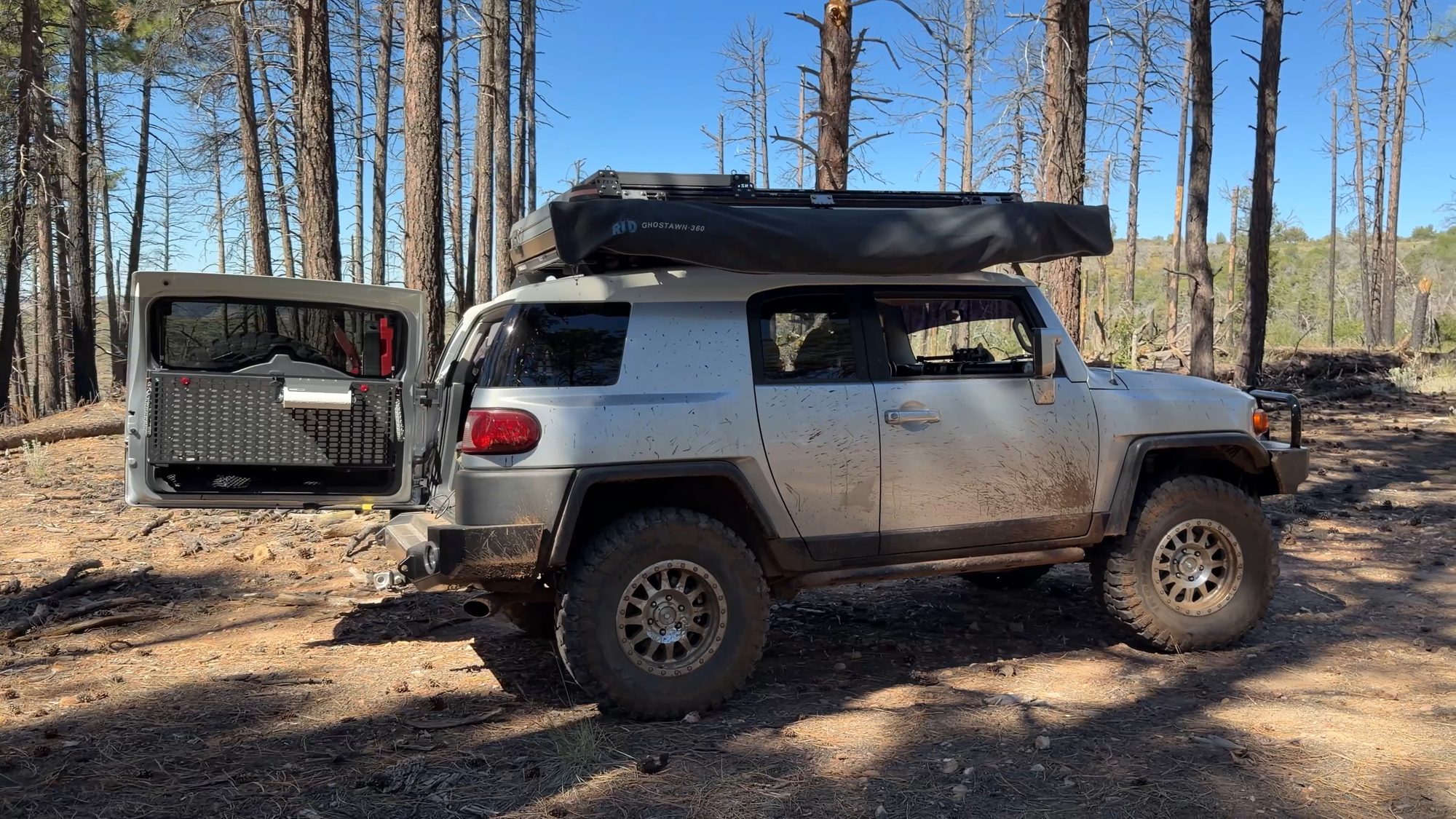
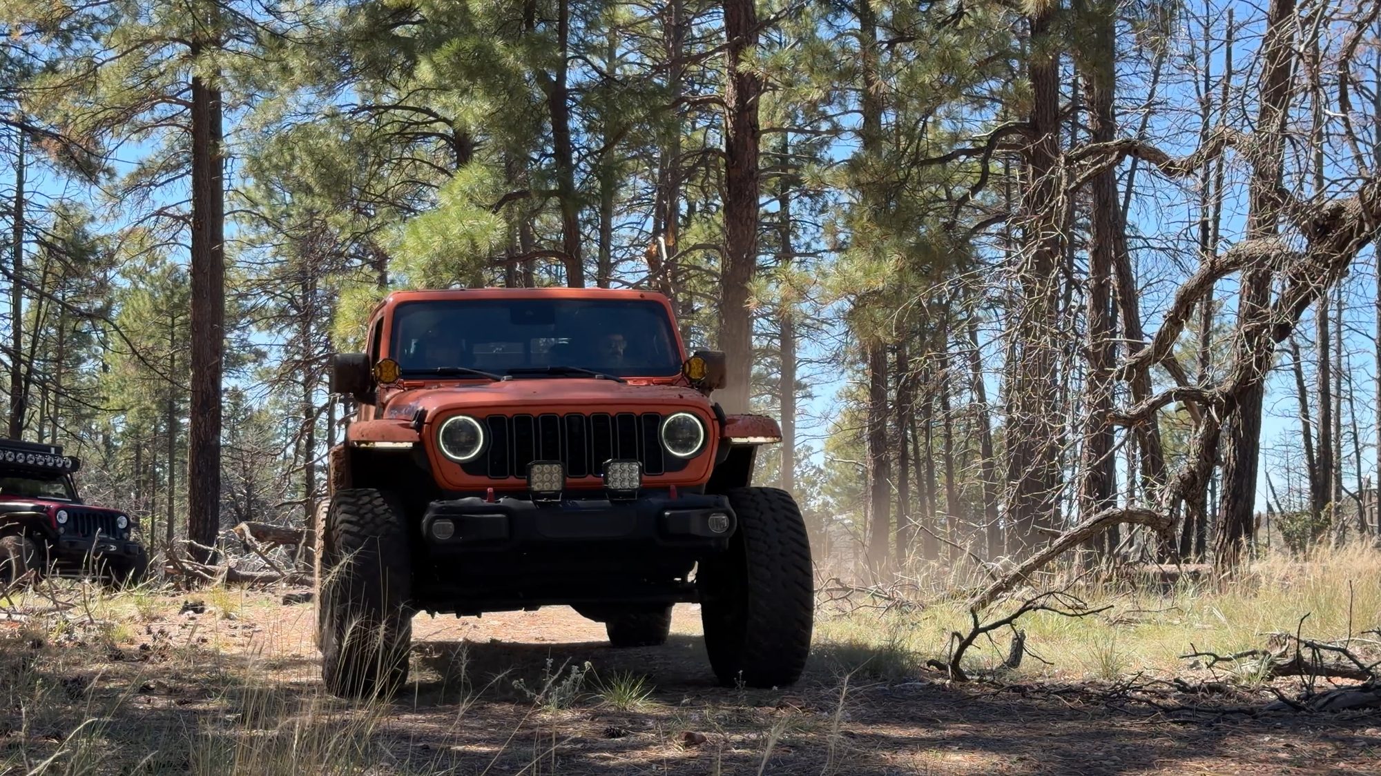
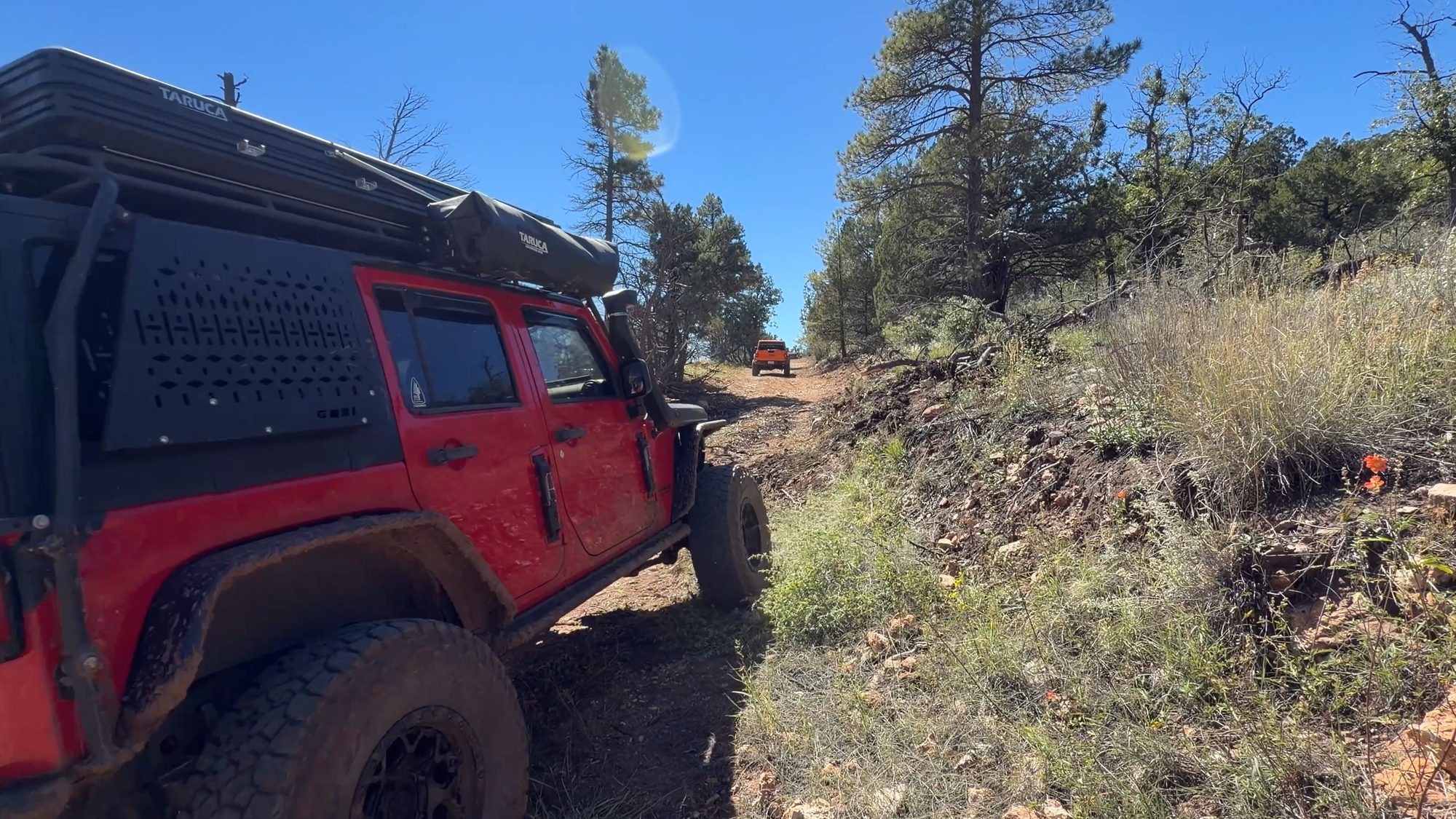
It was a smaller group this time, which made for a quick(ish) day on the trail. A downed tree and a lot of photo stops saw to the “ish.” Donovan from Millennium Overland (@millenniumoverland) brought his Hiker trailer, Randy (@rwayout) brought his FJ Cruiser, and Jose from Overlanding for Sanity (@overlanding_4_sanity) rode along with his buddy Tony (@tony5699) in Tony’s Gladiator, since Jose’s Jeep was in the shop. We brought Clifford, the Turtleback and our new Taruca rooftop tent on its very first trip.
Why it takes a permit
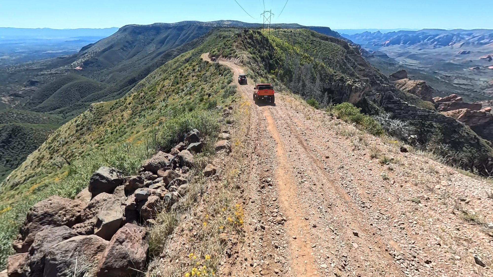
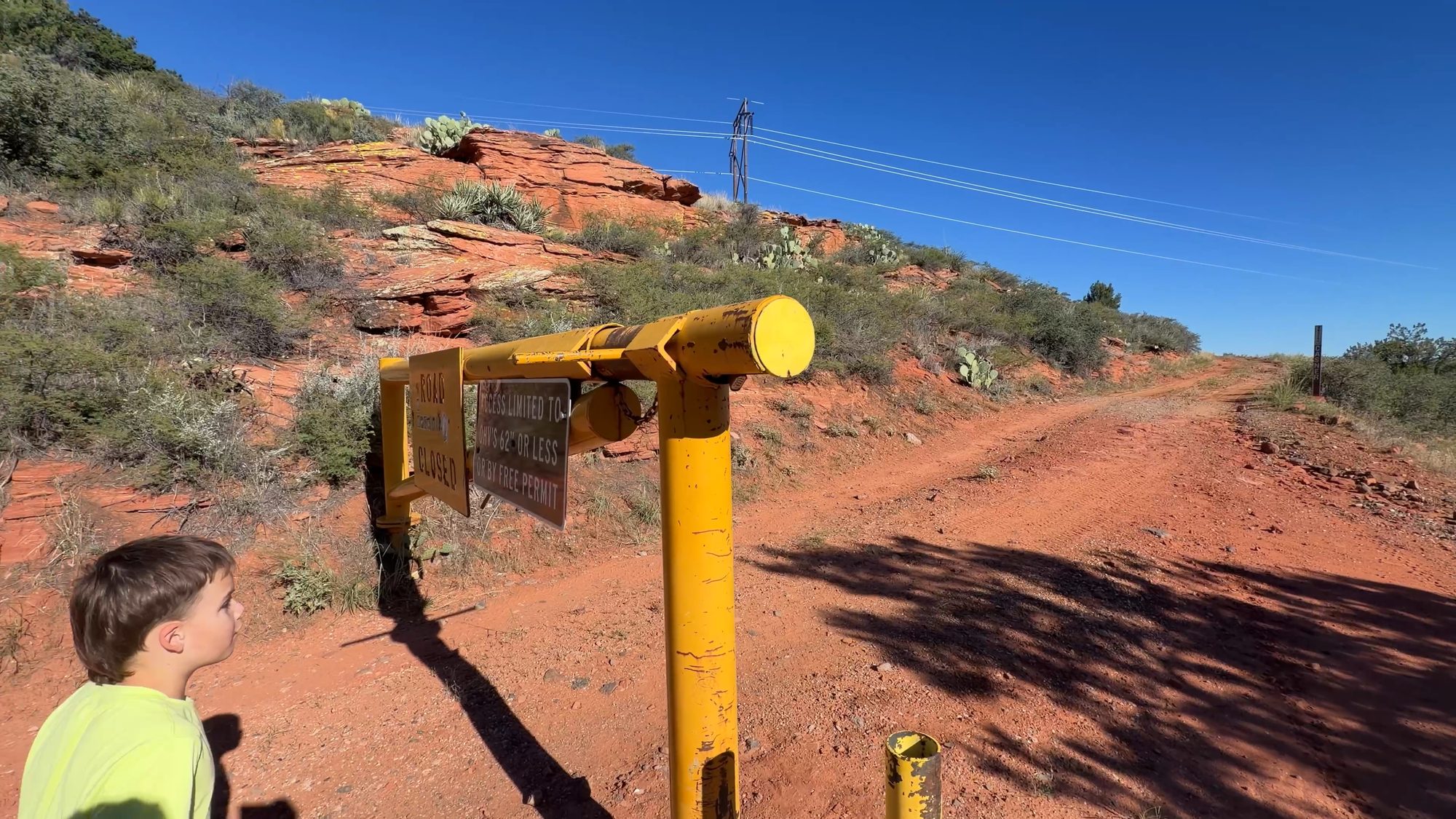
That yellow gate is what makes this trail special. The Forest Service hands out just one group permit a week, from mid-May to mid-October, and each permit caps how many people can come along. Do the math and only a couple dozen groups drive it all year. It isn’t the hardest trail in Arizona, but it might be one of the most beautiful, and knowing how few people get to see it makes every mile feel earned.
So how do you get one? The permit is free, but the process is old school: phone only. The Red Rock Ranger District opens reservations at 8:30 a.m. on the first Thursday in March for the early weeks (May through July), and again on the first Thursday in June for late July through early October. No voicemails, emails or texts. You keep calling until you get through, and then you take the next open week, because you don’t get to pick. Have a rough vehicle count ready. Groups need 3 to 10 vehicles and no more than 25 people, and the permit covers a single day. It shows up in the mail, and it has to be signed and in the vehicle with you on the trail. Vehicles under 62 inches wide, like adventure bikes and ATVs, don’t need one. They can use the road year-round by going around the gates. The current phone numbers and dates are on the Forest Service’s Casner Mountain page.
What makes it so rare is where it sits. The road rides a narrow spine of national forest between two wilderness areas, where otherwise no vehicles are allowed. On one side is the Sycamore Canyon Wilderness, set aside in 1972 and about 56,000 acres of red sandstone, white limestone and dark lava cliffs. On the other is the Red Rock–Secret Mountain Wilderness, set aside in 1984, with another 47,000 acres of the pinnacles, arches and slot canyons Sedona is famous for. Casner Mountain is a thin strip of road between them.
Camp in the pines
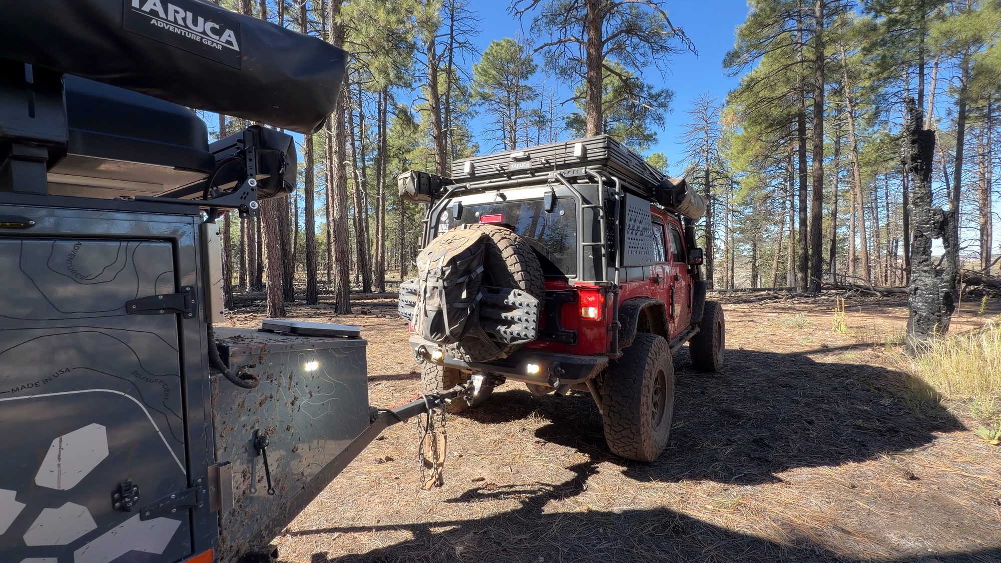
We set up base camp in the ponderosa pines on the north side, in the Flagstaff Ranger District, just outside the north gate. That’s where the trailers stayed. Casner’s switchbacks are too tight for a trailer, so we ran the trail as a day trip in the Jeeps and came back to camp at night. It’s an easy approach on graded dirt roads, about 25 miles from I-40, 26 from I-17 or 21 from 89A south of Flagstaff. From camp it’s another 18 miles over the mountain and down to 89A in Sedona. Top off fuel, air and water in Flagstaff before you head out. We used the Chevron on W Shamrell Blvd, right off I-17. There’s nothing once you leave town.
There’s a reason we camp up top. The trail ends in the Red Rock Ranger District, and most of the forest around Sedona and Oak Creek Canyon is closed to camping and campfires year-round, outside developed campgrounds and a handful of designated sites. Up on the Flagstaff side, the pines are open for dispersed camping, and it’s a lot cooler at 6,800 feet.
Picking a site up here takes more care than usual, though. The 2021 fire left the rim full of dead standing pines, and the same trees that come down across the road can come down on a camp. Before you park, look up. Skip any spot under dead trees or hanging branches. They’re called widow makers for a reason, and on the rim a gust of wind is all it takes.
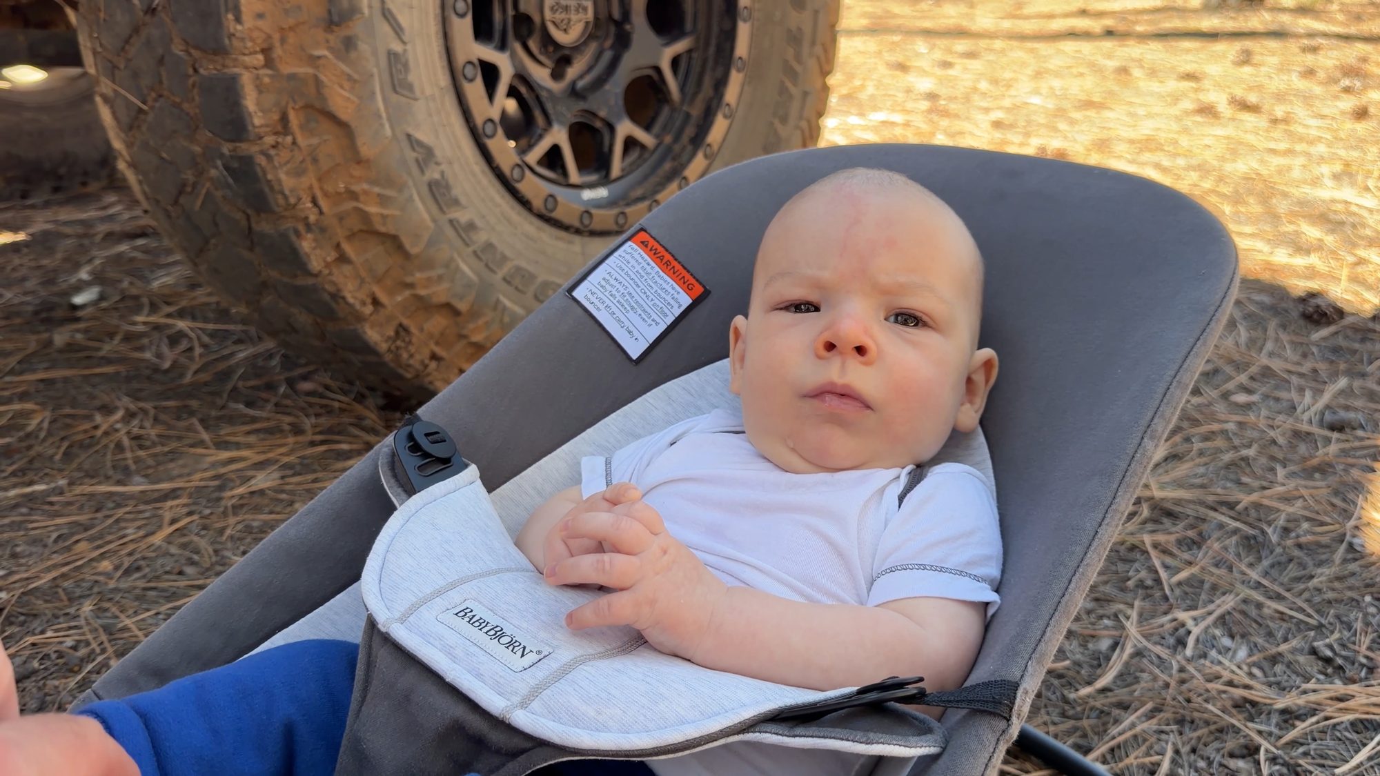
This was Collin’s second camping trip, and he was a natural: happy in his chair, watching the pines sway overhead. Meanwhile the older kids volunteered for mud duty, picking dried chunks off the Jeep and the trailer before we hit the trail.
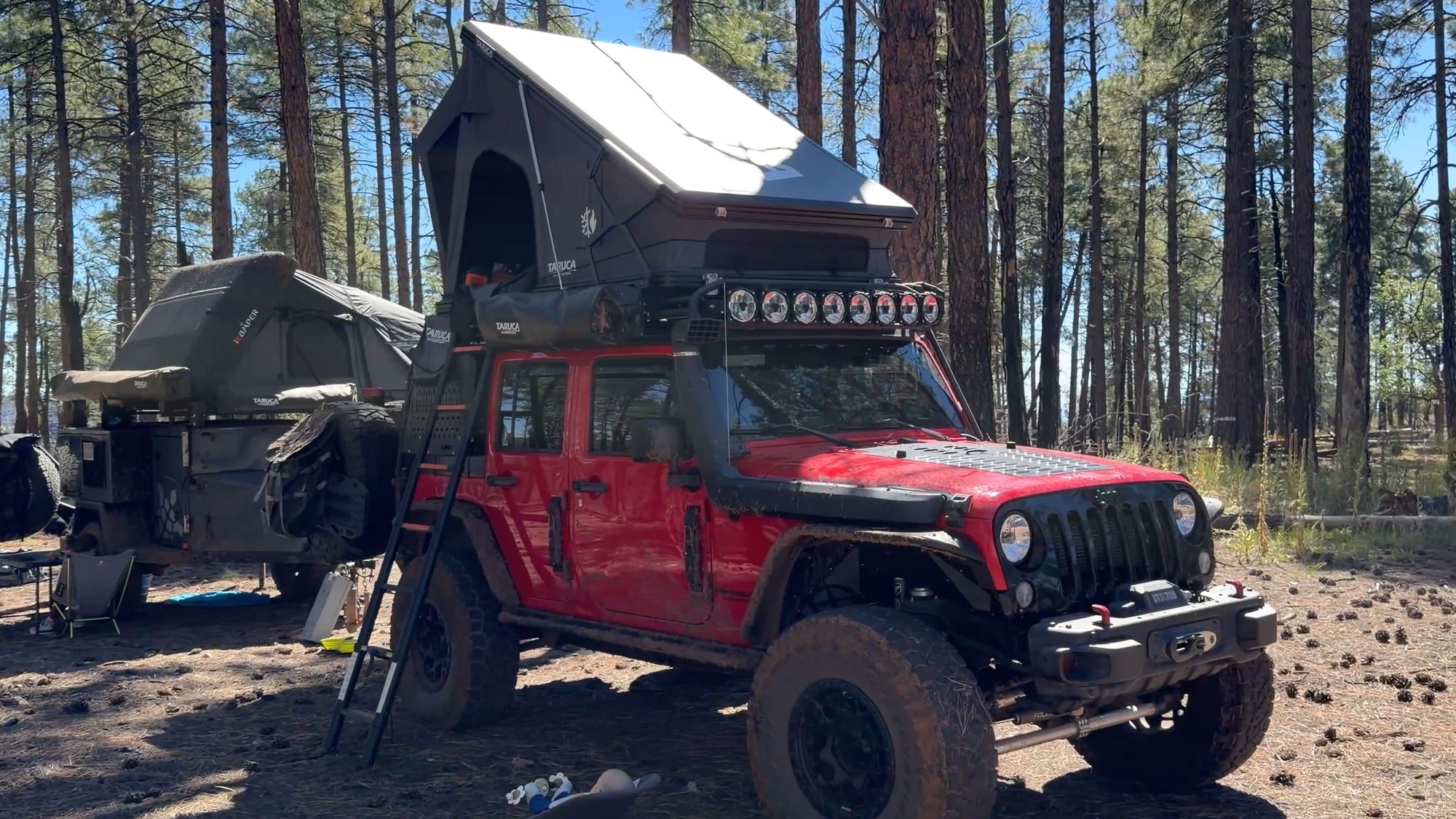
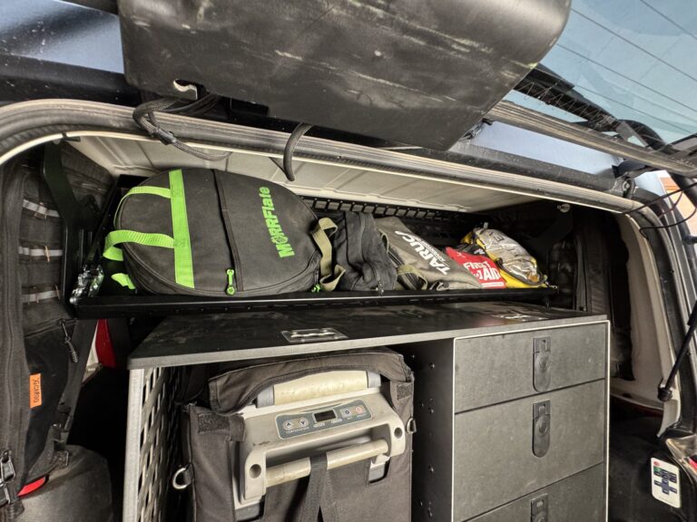
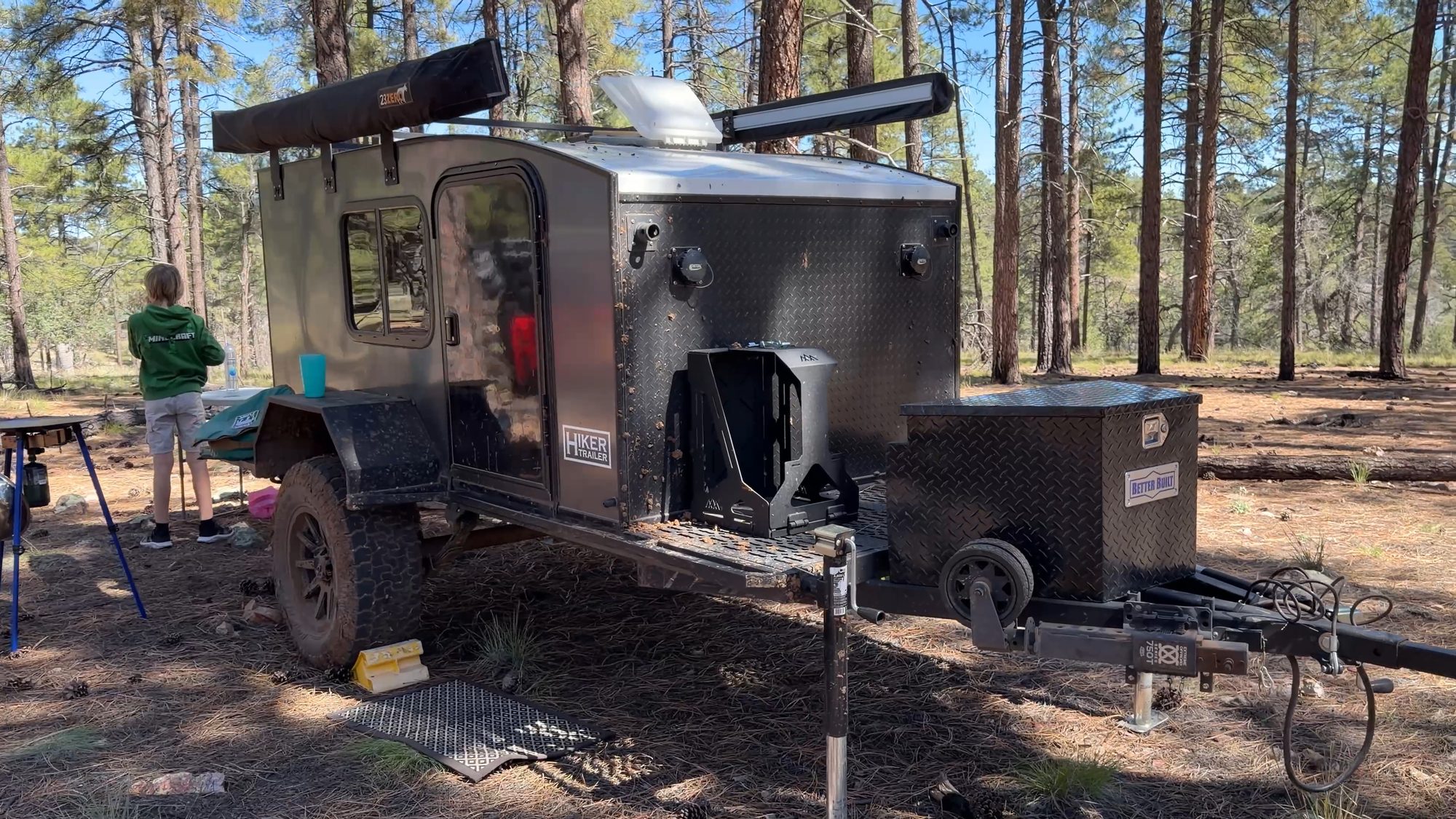
Before we rolled out we checked out everyone’s setups. Donovan’s had his Hiker trailer about as long as we’ve had the Turtleback, and it’s the kind of hard-sided camper we’d love to sleep in someday: out of the elements, with all the amenities. Randy’s FJ has an awning, an FSR rooftop tent, drawers, a fridge and power, and he packed it all down in minutes. I miss the days when I could pack up that fast. With three kids and two dogs, it takes us a little longer now.
A tree in the way
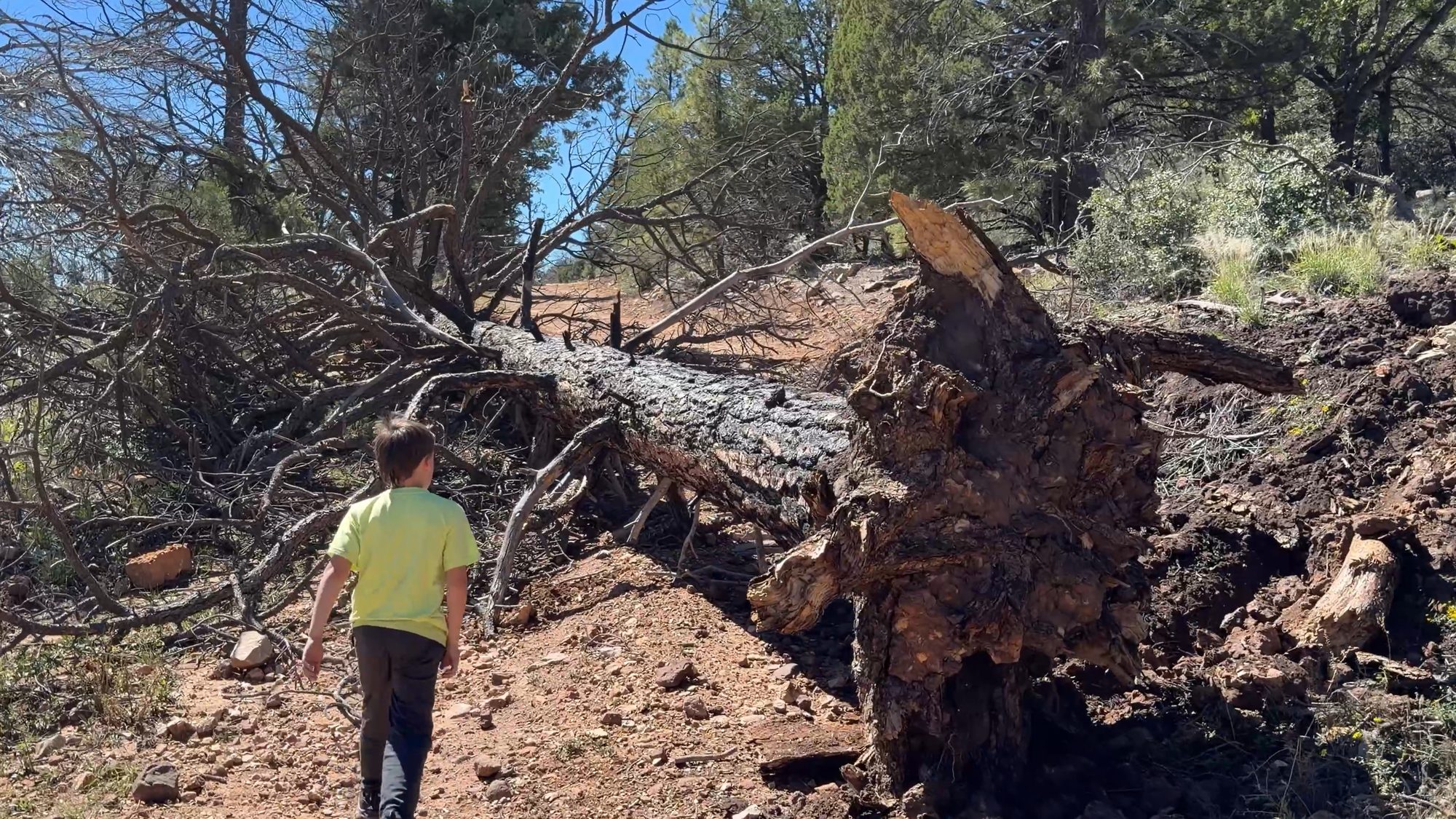
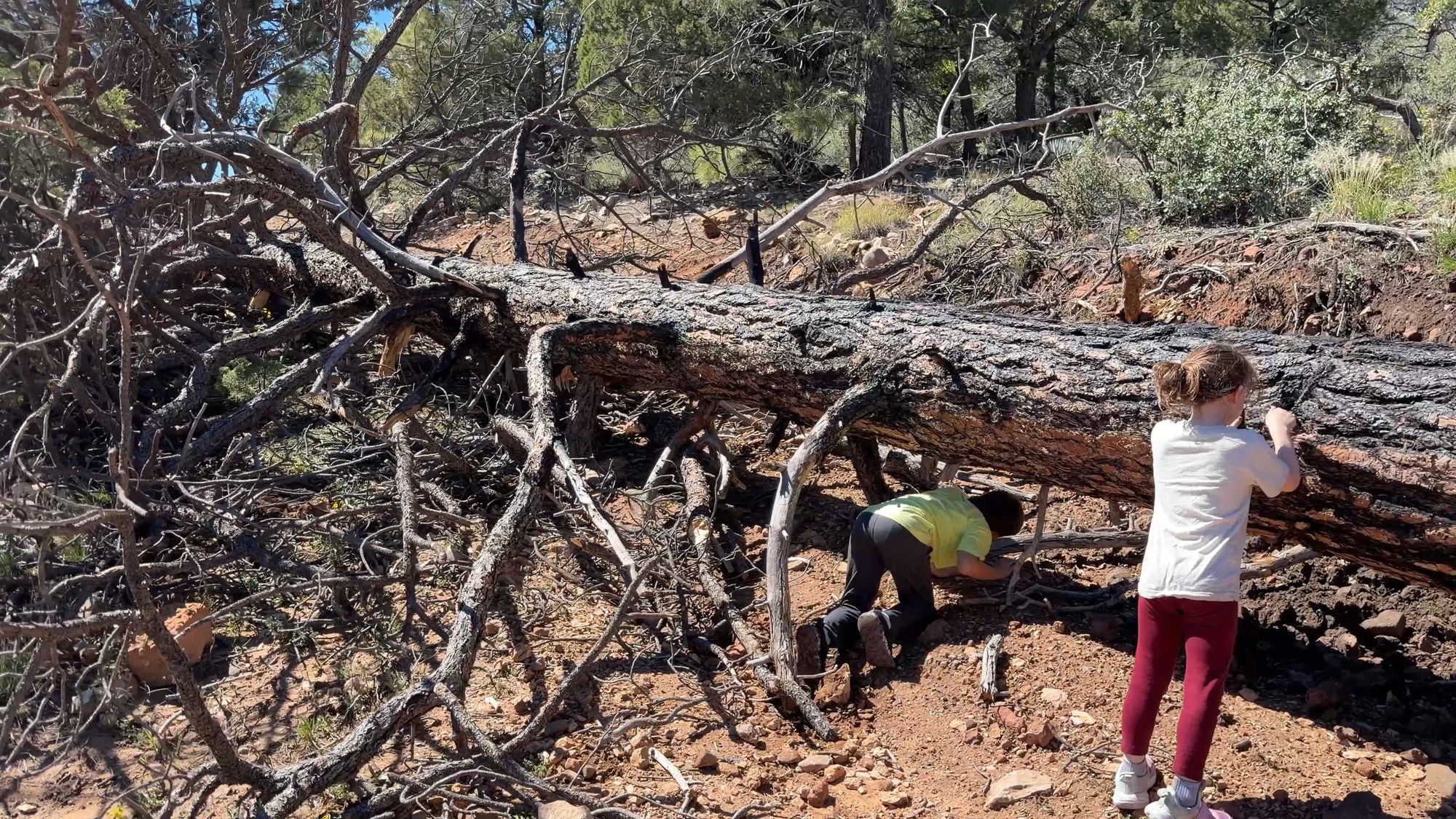
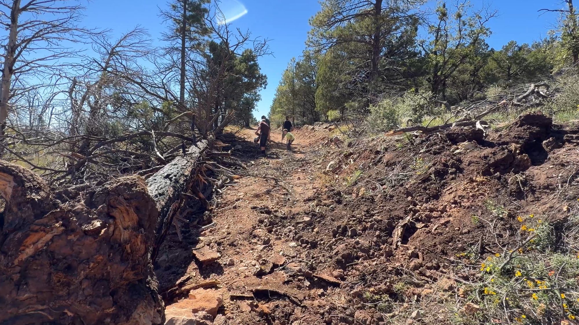
We figured the first quarter mile would be the easy part. Casner had other plans. We hadn’t even reached the north gate on 538B when we found a big ponderosa lying across the road, roots and all. In June 2021, the lightning-sparked Rafael Fire burned up through Sycamore Canyon and onto the rim right here at Casner Mountain, about 78,000 acres in all. Five years later, a lot of the trees it killed are still standing, and one by one they’re coming down. This is the only way in from the Flagstaff side, and after years of waiting for a permit, turning around wasn’t an option.
Our first try pulled down on the trunk and just dug the root ball into the dirt. So we re-rigged the strap lower, and Donovan’s Jeep winched the base across the road. The tree was bone dry, and the branches snapped off as it moved. Then the chainsaw came out to clear the rest. Tire tracks showed that people had already been driving around it through the brush, but we wanted to do it right and leave the road open for whoever comes next. If you find a tree down out here, please don’t route off the road. Clear it if you can, or turn around.
On the ridge
With the road clear, we unlocked the gate and got back to what we came for. Past the burn scar, the pines thin out, the road climbs onto the ridge and everything opens up. Behind you, the San Francisco Peaks and Humphreys Peak, the highest point in Arizona, fill the skyline. On either side the ground falls away into wilderness canyons, red rock on one side and pale limestone on the other. In early October the slopes were covered in yellow wildflowers. It’s the kind of place where the radio never goes quiet, because everyone keeps calling out the next view.
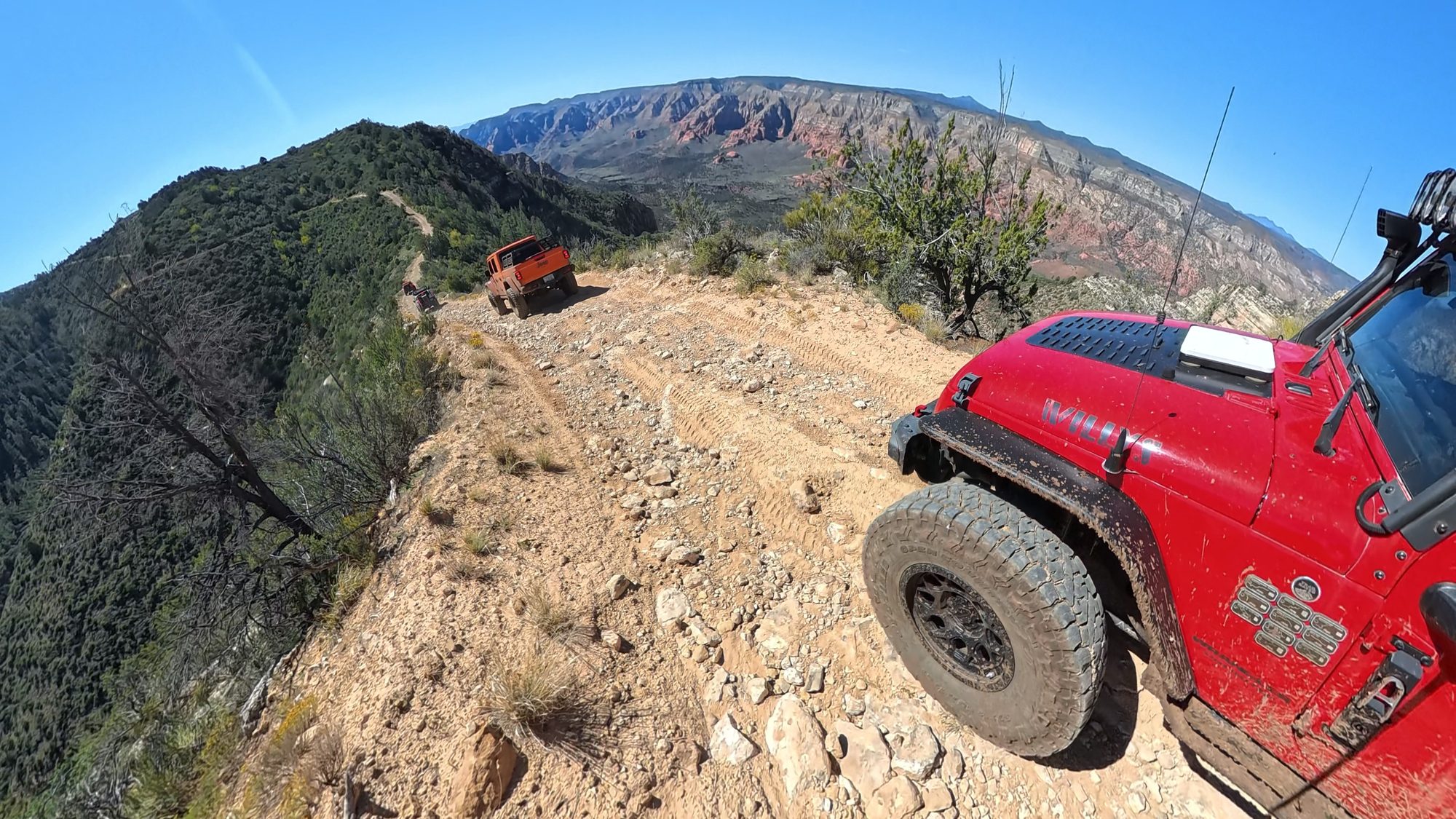
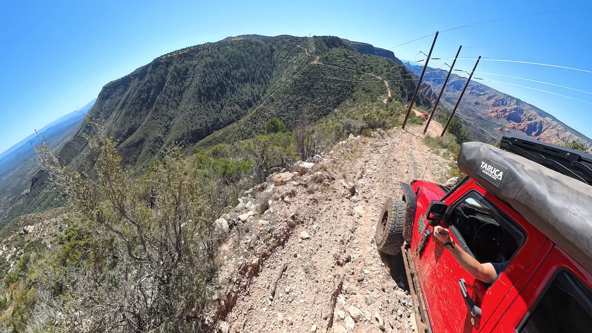
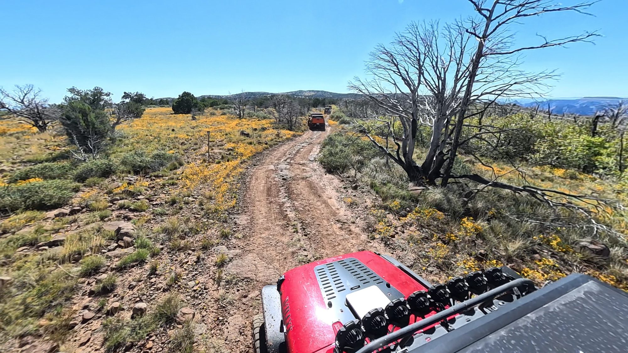
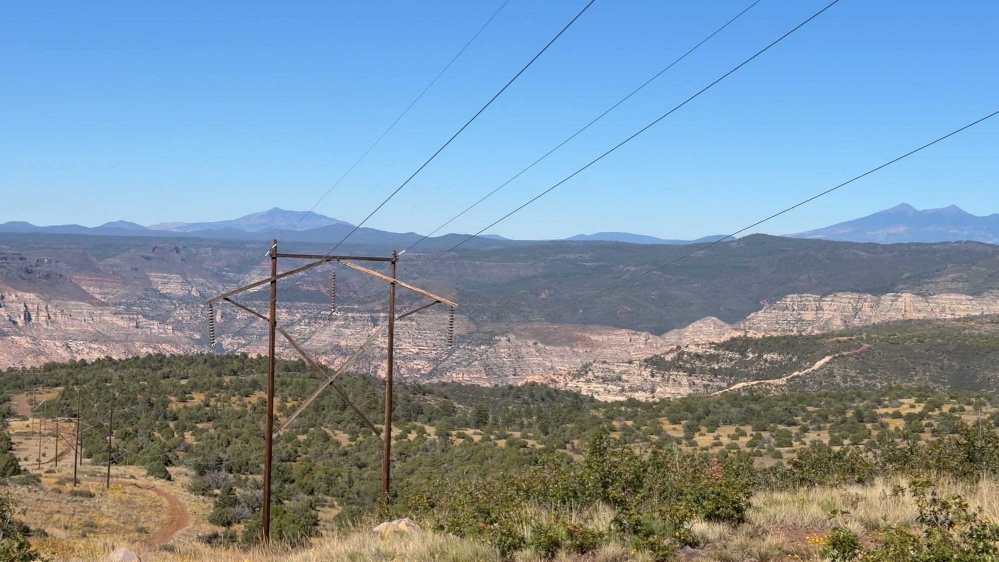
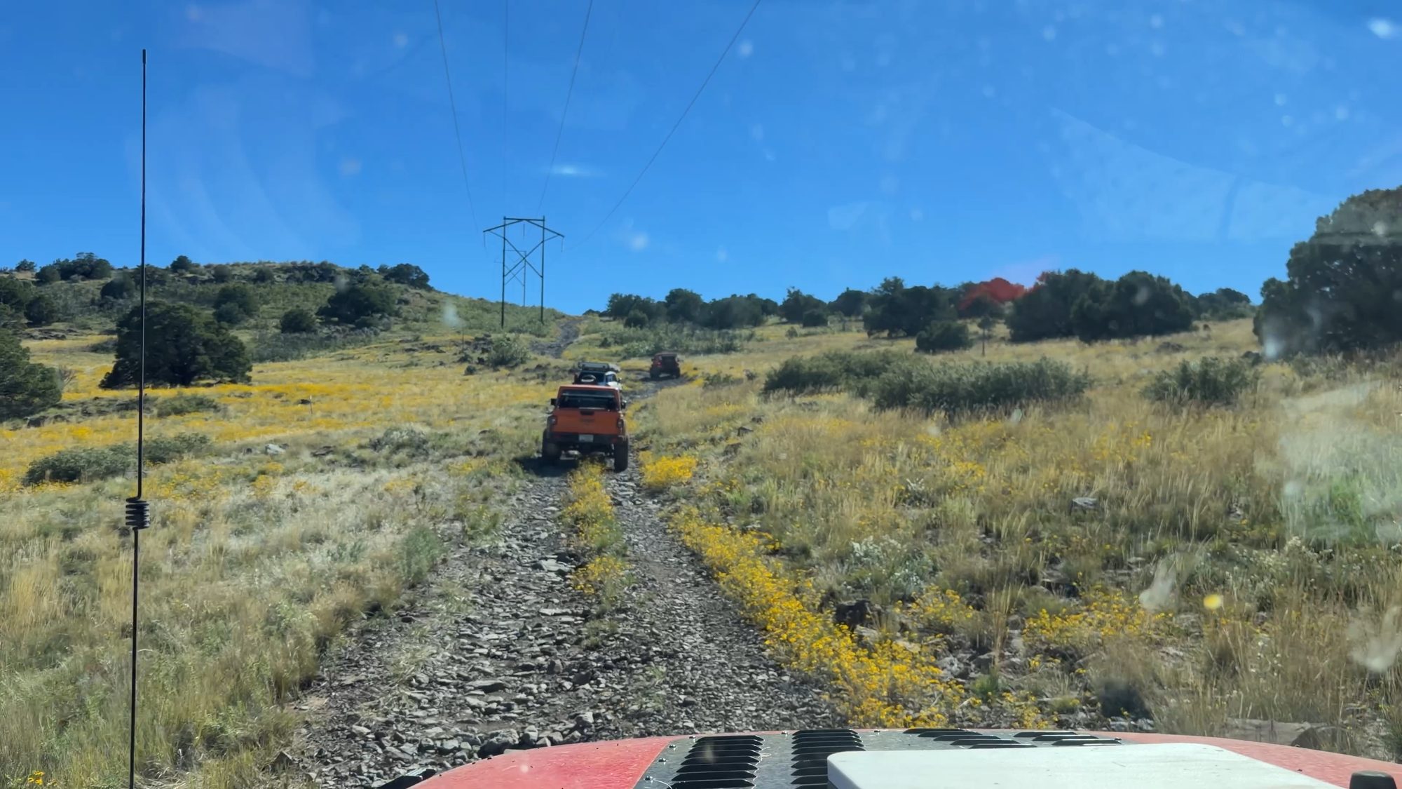
About two-thirds of the way through, we pulled over for sandwiches. From there you can look back on the whole ridge you just drove. Ahead, the road tips over the edge toward Sedona, and way across the Verde Valley you can pick out Jerome, the old copper-mining town clinging to the side of Mingus Mountain. The sun was starting to cook us, so we didn’t linger. The best part was still ahead.
The switchbacks
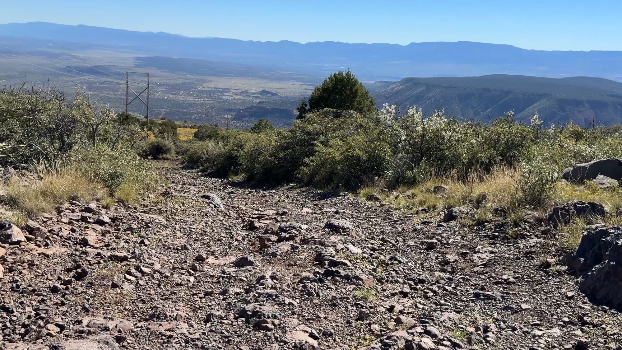
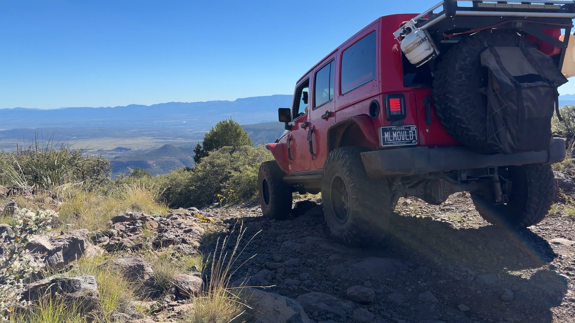
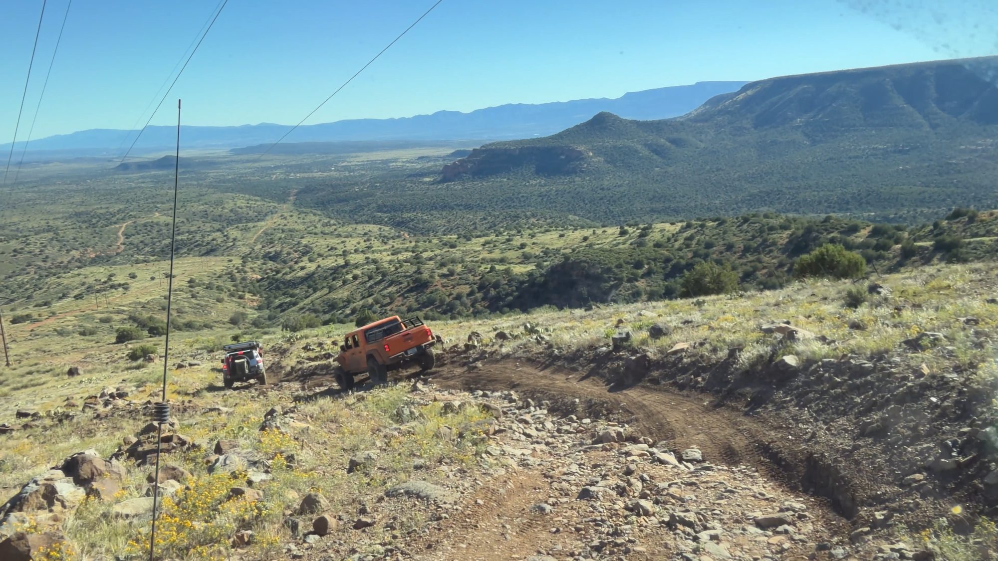
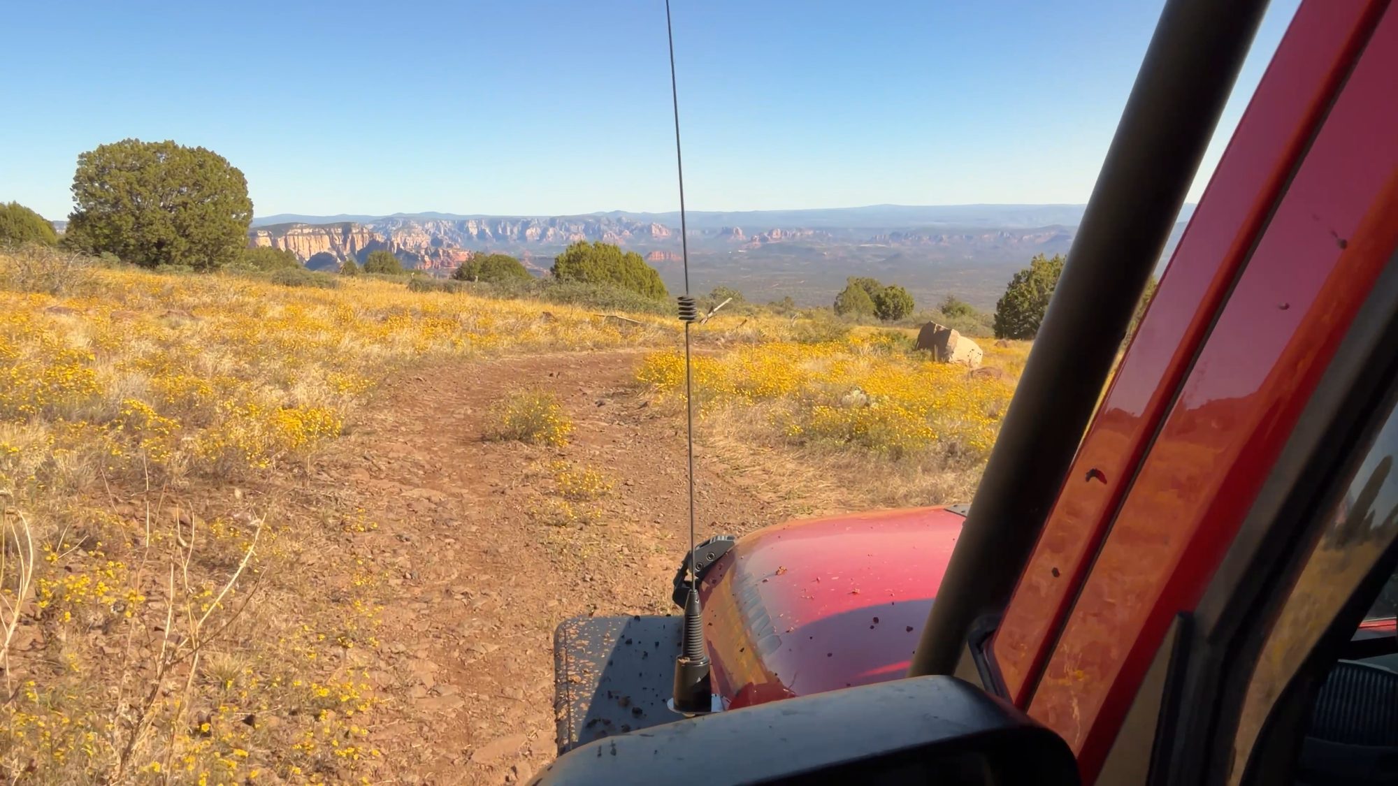
This is the part I’d been waiting for. From the 6,800-foot high point you drop almost 3,000 feet by the time you reach the highway, and nearly 2,000 of that comes in the last two and a half miles before the south gate, through a stack of tight switchbacks cut into the face of the mountain. It isn’t technical, but it’s steep, loose and exposed. The views are big enough that it’s hard to keep your eyes on the road.
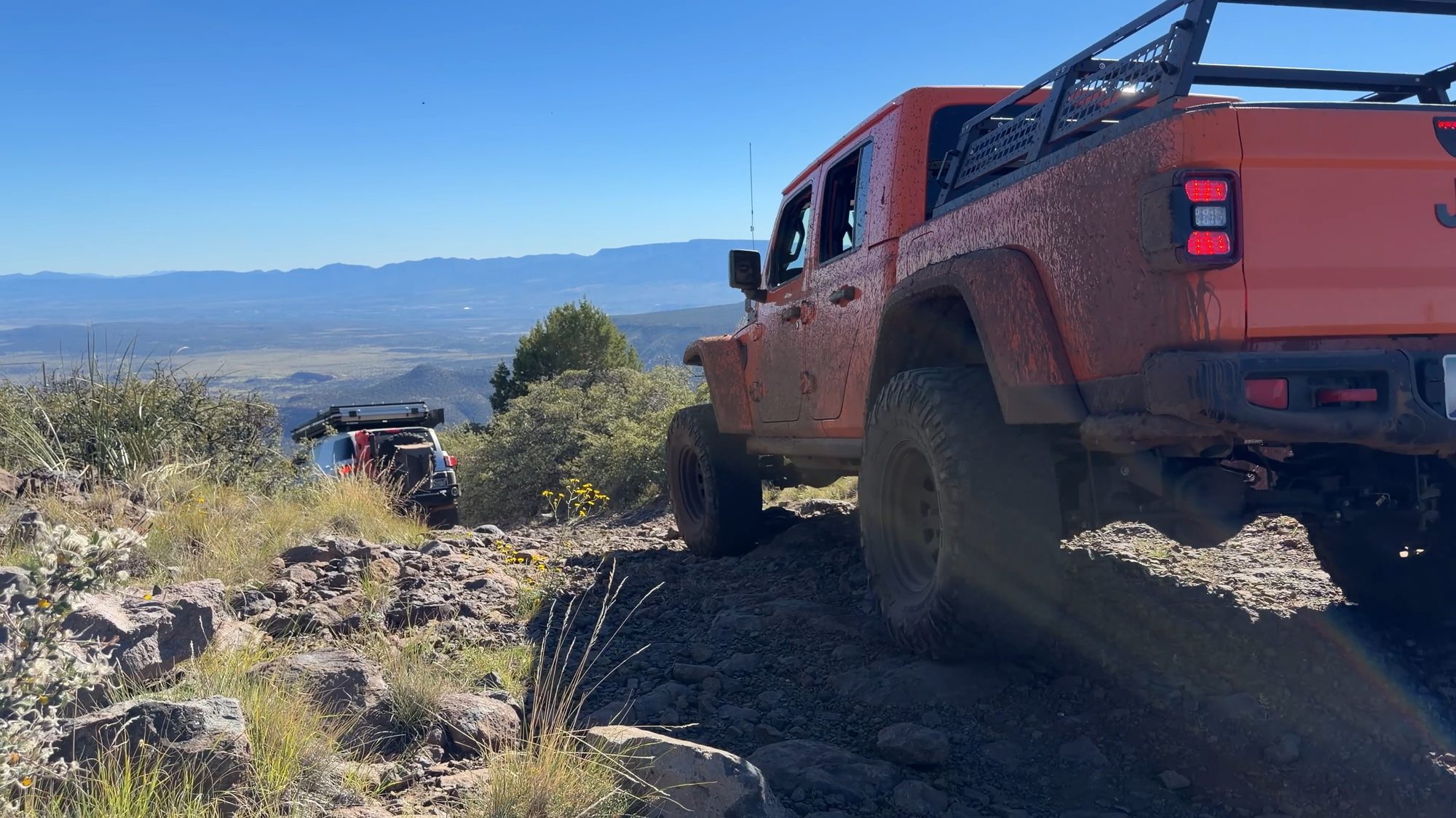
Conditions have changed. In 2021 this was an easy, mostly well-graded road with exposure on the switchbacks and ridges. In 2022 there was a little more erosion, but nothing major. This year the switchbacks, and the stretch leading into them on the Sedona side, are significantly more eroded. The ruts tip you toward the downhill side, and there’s moderate off-camber with exposure. Randy’s FJ went up on three wheels in one washed-out switchback, the kind of moment that gets the whole group’s attention. That’s why I’m now rating it moderate.
It’s still very doable in a stock 4×4 with a confident driver. Use 4-low, go slow, keep steady throttle and braking, and pick your tire placement carefully through the ruts.
Down into Sedona
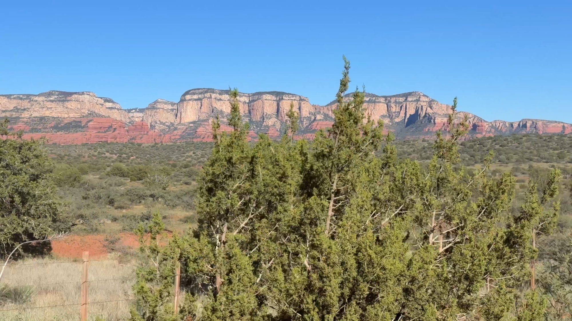
Then the switchbacks run out, the dirt turns red and Sedona’s cliffs are right in front of you. It feels like you drove from one state into another in an afternoon. We locked the south gate behind us, and the last 10 or so miles to 89A are easy graded dirt through juniper and red rock.
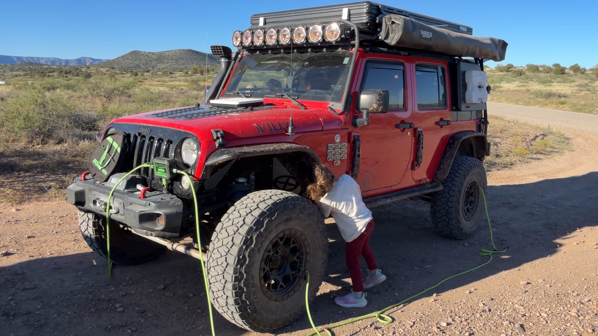
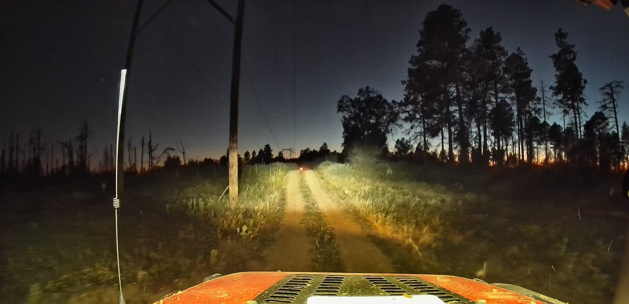
There’s a big pullout right next to 89A that’s perfect for a group to air up. We used our MORRFlate four-tire kit with the Air Hub, set it to 36 PSI, and all four tires filled together. Then it was into West Sedona for pizza at Famous Pizza & Beer. The verdict from the back seat was “Good!” and yes, it was. After dark, our KC Gravity headlights and Titan light bar lit the long drive back up 89A to camp. Pizza boxes by the fire, a few stories, and lights out.
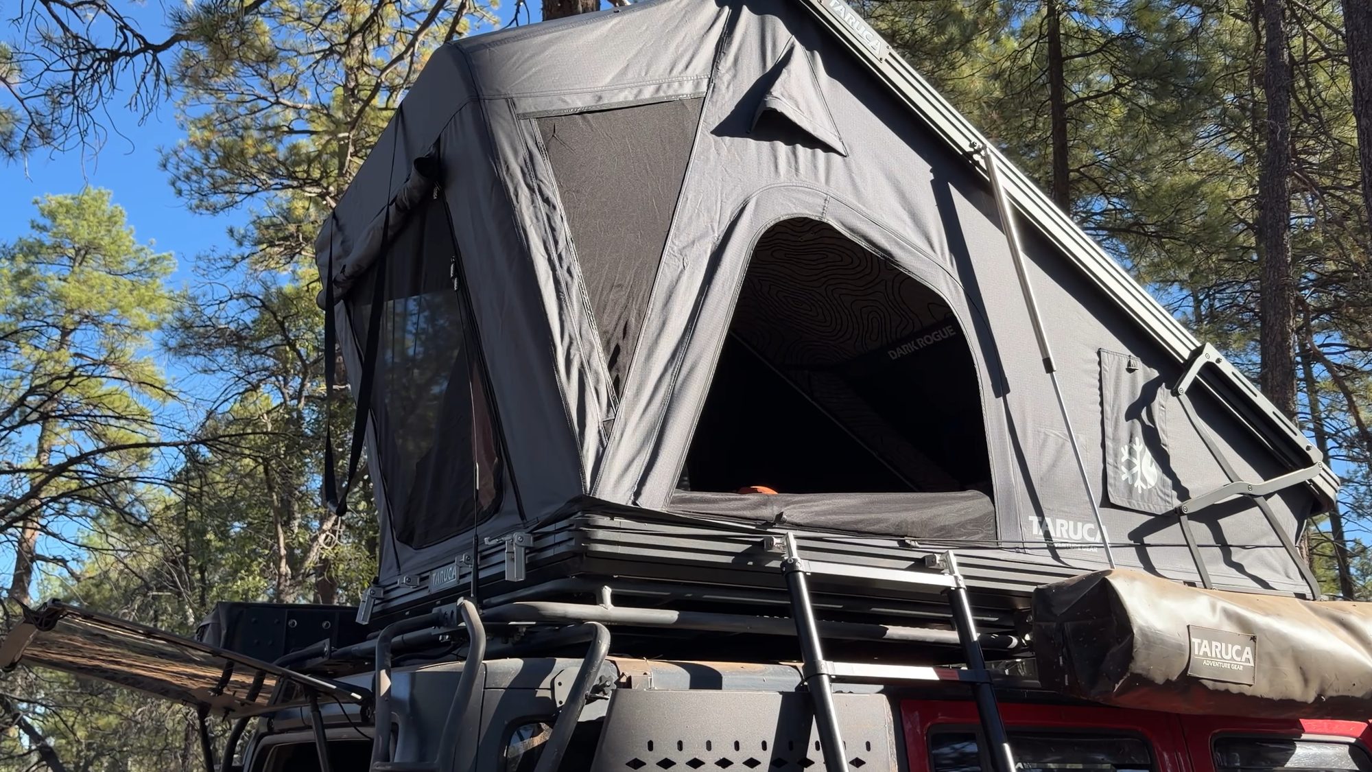
First trip with the Taruca tent
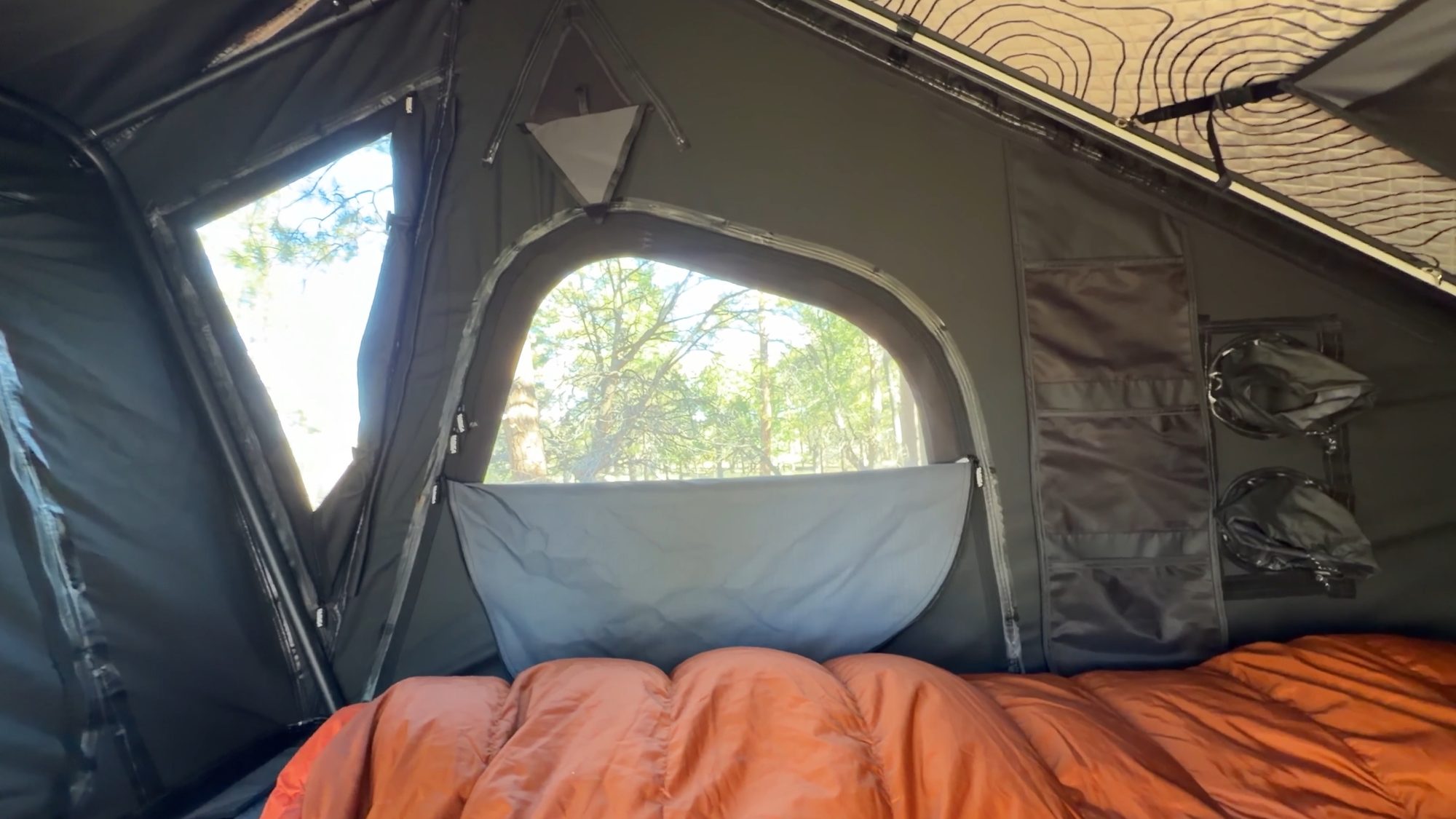
This was the first trip for our new Taruca Dark Rogue 2.0. First impressions: it opens and closes about as easily as a rooftop tent can, it’s pitch black inside even in broad daylight, and the little details are really well thought out.
- No external tension rods for the rain fly. Taruca sells a lot of 270 awnings, and those rods get in the way when the awning is open. The supports flip out from inside instead.
- A ladder that collapses with two toggles. You don’t have to release each rung.
- A kick-up at the front for extra foot room, plus windows and vents on every side.
- His-and-hers charging (USB-C, USB-A and 12V on both sides) and an Anderson plug underneath for hardwiring.
- Diesel heater and AC ports, storage pockets, a 2A holster and two shoe bags that dry out muddy shoes.
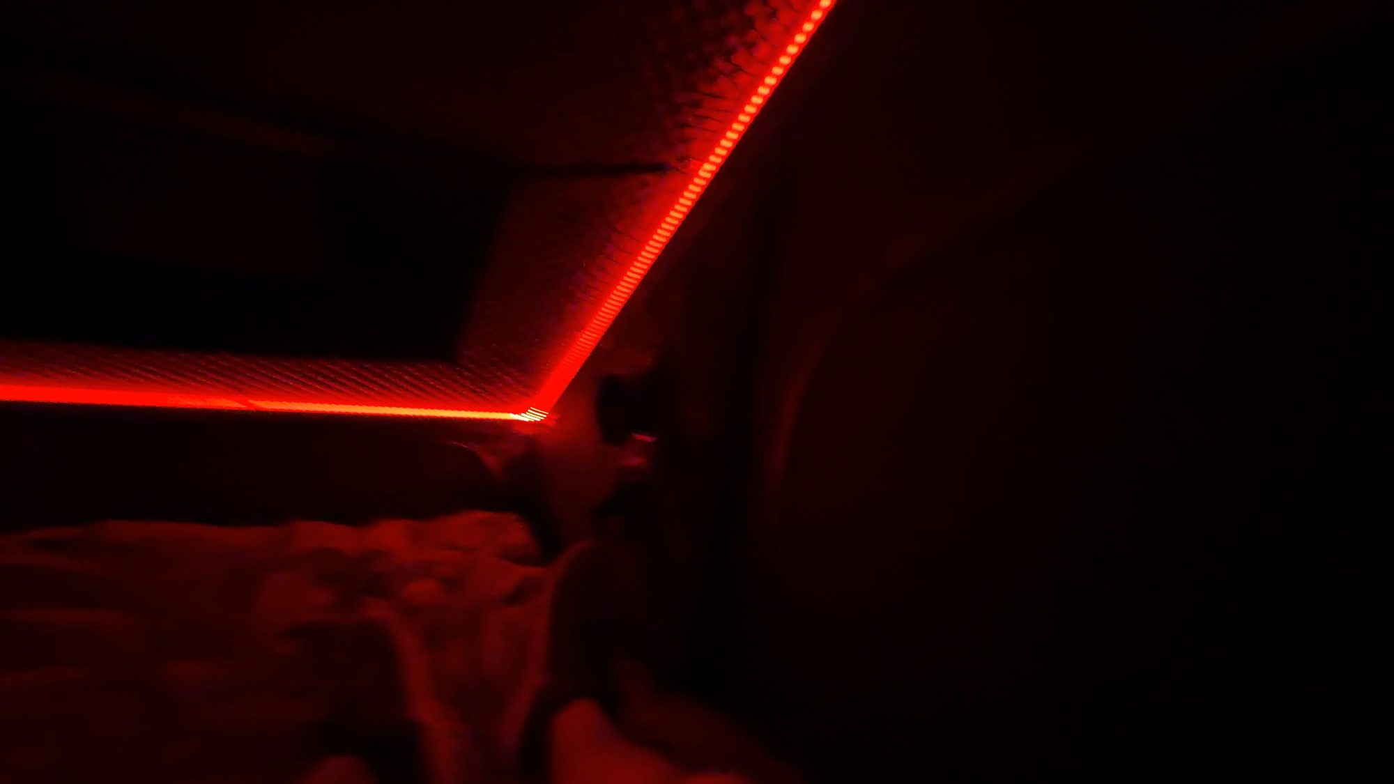
- RGB lights inside, plus lights on the underside of the tent. I only show red in the video, which lets you see without wrecking your night vision.
A tip for any rooftop tent: this isn’t a Taruca thing. Whatever RTT you run, leave a window or two partly open when you close it up. The air has somewhere to escape, and the canvas tucks in much more easily.
History and points of interest along Casner Mountain
Casner Mountain has been a highway for a lot longer than there’s been a road on it.
Look at a map and Casner Mountain starts to make sense. Oak Creek Canyon cuts down one side, narrow and steep-walled. Sycamore Canyon cuts down the other. Between them, Casner is a long, unbroken ridge that runs all the way from the rim to the Verde Valley without crossing either canyon. A ridge like that is a natural highway.
Long before cattle, people were moving between the rim and the valley. The Sinagua farmed both ends of this ridge, from the cinder country around Flagstaff to the Verde Valley, and built the cliff dwellings at Honanki and Palatki a few miles from the south gate. By the early 1400s they had moved on, and several Hopi clans trace their roots to them.
After them, this was the homeland of the Yavapai and the Dilzhe’e, or Tonto Apache, whose country covered more than 16,000 square miles of central Arizona. In 1871 the United States set aside a 900-square-mile reservation for them along the Verde River near Camp Verde. It lasted less than four years. Settlers wanted the fertile valley, and the Tucson Ring, a group of businessmen who profited from supplying the reservations, didn’t want to lose their contracts. On February 27, 1875, the government marched 1,476 Yavapai and Apache people about 180 miles to the San Carlos Reservation, in winter, over snow-covered mountains and flooded rivers. The Indian commissioner refused wagons for the elders, women and children. More than 100 people died on the way.
By the 1890s, families began walking home from San Carlos, only to find their land fenced and settled. The Yavapai-Apache Nation was federally recognized in 1934, still lives in the Verde Valley today, and marks the removal every February as Exodus Day.
Then came the cattle. Ranchers moved into the Verde Valley in the years after 1875, onto land the Yavapai and Apache had just been forced to leave. By the 1890s the Casner ranching operation was running cattle between the high country and the valley, and they cut their own livestock trails up the cliffs to do it. Casner Canyon, in Oak Creek Canyon, carries the family name on another stock trail they built. Every year the herds went up to summer range on the Mogollon Rim and back down to winter grazing in the valley, and this ridge was one of the ways up. Picture driving cattle down those switchbacks on horseback, with no road at all.
Decades later, the same geography that made it a good cattle route made it a good power line route. Oak Creek Canyon works for a highway, but it’s a hard place to string transmission towers. The ridge is the most direct line between the rim and the valley, and that’s likely why the power line came over Casner Mountain too. A road was cut to maintain it, and that’s the road you drive today, following those towers almost the whole way.
Then came the wilderness. When the two wilderness areas on either side were set aside, their boundaries were drawn around the road, leaving a thin strip of national forest open to vehicles between them. The cattle route became a power line road, and the power line road became the only way to drive through this country. The mountain and the trail still carry the Casner name.
- Jerome. From the lunch stop you can pick out Jerome across the Verde Valley, clinging to the side of Mingus Mountain. It boomed on copper in the early 1900s, nearly became a ghost town after the big mine closed in 1953, and is now a funky little town of artists, galleries and old buildings. Worth a stop if you have a spare afternoon.
- Honanki Heritage Site. Honanki means “Bear House” in Hopi. It was named in 1895 by Jesse Walter Fewkes of the Smithsonian, and it was one of the largest cliff dwellings in the Verde Valley. The Sinagua lived here from about 1150 to 1350, and some of the rock art on the walls is around 4,000 years old. It’s just off the road on the Sedona side. You’ll need a Red Rock Pass ($5 a day) or an America the Beautiful pass, and it’s open 9:30 a.m. to 3 p.m.
- Robbers Roost. A short, steep scramble (about half a mile) to a red rock alcove with a perfectly round window in the wall. Local legend says bandits and bootleggers used it as a hideout, though no one’s ever proven it. The last stretch is an exposed ledge, so skip it after rain or if heights aren’t your thing.
What worked, what broke
Worked
- Taruca Dark Rogue 2.0. First trip, and it opened and closed in seconds. It’s pitch black inside, even in broad daylight.
- MORRFlate four-tire kit with the Air Hub. Set 36 PSI at the 89A pullout and all four tires filled together.
- Starlink on a Veritas Vans hood mount. Cell service is extremely limited out here. The hood mount kept us connected on the trail, and at camp we ran Starlink off the trailer.
- KC Gravity headlights and a Titan light bar. They made the long night drive back up to camp easy.
- A winch, a strap and a chainsaw. Without them, the downed tree would have ended the trip before the gate.
Broke / would change
- My shocks. The old shocks really showed their wear on the eroded switchbacks. New Falcon 3.3 piggyback shocks are in the garage and going on before the next trip.
- A battery light on the way home. Clifford showed some unusual battery charging behavior while the trailer was charging. It’s likely on the trailer side, but we have some diagnostics to do to find the cause and the fix.
Featured partner
Taruca Dark Rogue 2.0
Save 10% on the Dark Rogue 2.0 and the rest of Taruca’s gear with my code. I work with Taruca USA, and the code supports the channel.
Code OVERLANDAZ
Featured partner
MORRFlate Air Hub
Set a target PSI and the Air Hub airs down or up on its own and beeps when it’s done. With the four-tire kit, all of Clifford’s tires fill at the same time.
Shop via my link
Know before you go
- Permit required. Casner Mountain Trail #8 is gated and locked at both ends. Permits are free and booked by phone only through the Red Rock Ranger District, starting at 8:30 a.m. on the first Thursday in March and June. One group a week, 3 to 10 vehicles, 25 people max, one day. Adventure bikes, ATVs and other vehicles under 62 inches wide don’t need one. Current details are on the Forest Service page.
- No camping or campfires between the gates. Run it as a day trip and camp outside either end. Most of the Sedona side is under a year-round camping and campfire closure outside developed campgrounds and designated sites, so we based on the north side in the Flagstaff Ranger District.
- Watch for widow makers at camp. The rim is full of dead standing pines from the 2021 fire. Look up before you park, and don’t camp under dead trees or hanging branches.
- Leave the trailer at camp. I don’t recommend towing down this trail. The switchbacks are too tight.
- Lock the gates behind you.
- Expect downed trees on the north side. Bring a saw and a strap, and don’t route off the road.
- Moderate in 2026. The switchbacks are eroded with off-camber and exposure. Use 4-low and go slow. A stock 4×4 with a confident driver is fine.
- Fuel up in Flagstaff. The Chevron on W Shamrell Blvd, right off I-17, is the last stop for fuel, air and water. The approach roads are graded dirt: about 25 miles from I-40, 26 from I-17 or 21 from 89A to the north camp, then 18 more over the mountain to 89A in Sedona.
- Air up at 89A. There’s plenty of room at the pullout on the Sedona side.
The verdict
In one day you go from ponderosa pines on the Colorado Plateau to the red rocks of Sedona, on a ridge that has carried Sinagua farmers, Yavapai and Apache families, cattle drives and power lines, between two wildernesses most people will only ever see from the edge. The permit is what keeps it that way, and it’s why it still feels like a privilege to drive. The switchbacks are rougher than they used to be, so take your time. If you ever get the chance at a permit, jump on it, and leave it better than you found it.
Get the next trip report first.
One email when a new report drops. GPS tracks and camp spots for subscribers first.